Map Prints

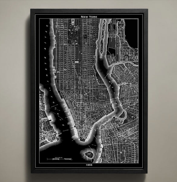
Map Print, NEW YORK CITY
$29.00
The black version of our magnificent New York City map print highlights the abstract detail of this piece of art and the original cartographer's work. Its white version makes the streets, waterways and bridges jump out at you. Whether you're drawn to the black or the white city map prints, there's no mistaking what city is depicted in these maps. Those who love NYC will enjoy discovering it block by block. All of our map prints are printed on high quality archival paper that will last a lifetime. This 1855 New York City map print will take you back in time and add character to any wall in your home or office. If you are looking for another city to pair with our New York City map print you can view our entire collection of map prints here:
Frame not included.
© Copyright 2013 GeoArtShed. Artwork may not be reproduced or resold
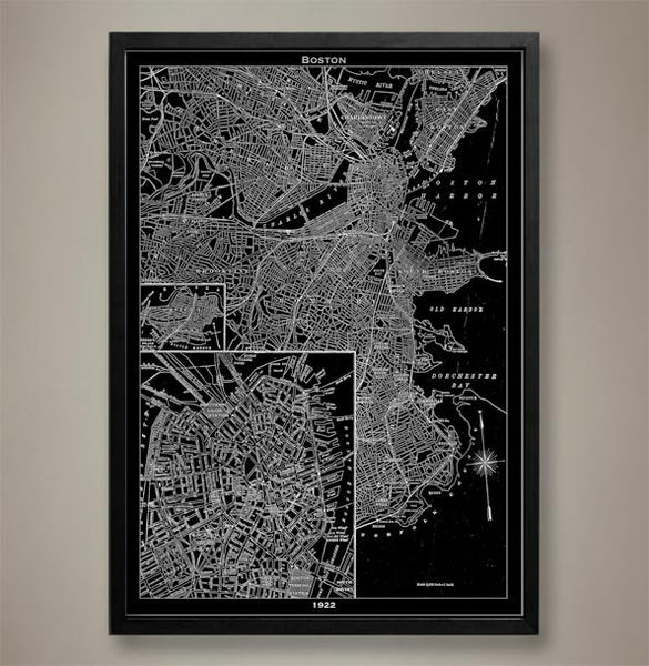
Map Print, BOSTON
$29.00
This historical Boston map print is a recreation of an original map created by an extremely well known topographer in 1922. This vintage style map was reimagined in the form of a Boston poster but the original lines and details have been preserved using high quality cardstock and premium ink. Boston was entering a period of decline at the time of this maps creation and a renewal project was set to ramp up commerce once more. This Boston poster lets you examine the streets from a distance and close up and will immediately bring to mind cobbled walkways, thick accents, and a historical pride that can only be found among the people of Boston, Massachusetts.
The purchase of this listing is for one Boston city map print with the following specifications and options:
Style: Map of Boston, Massachusetts (Circa 1922)
Sizes available: 18 x 24, 24 x 36 or 36 x 48 inches
Colors available: Black or white
Materials: 100# premium card stock
Please note the purchase of this Boston poster does not include a frame. Your map of Boston poster will be mailed via USPS First Class and preserved in a durable shipping tube. If you would like to continue to shop for more Boston home décor, Massachusetts home décor, or map prints for a different city you may return to the GeoArtShed by clicking the following link: City Map Prints
© Copyright 2013 GeoArtShed. Artwork may not be reproduced or resold.
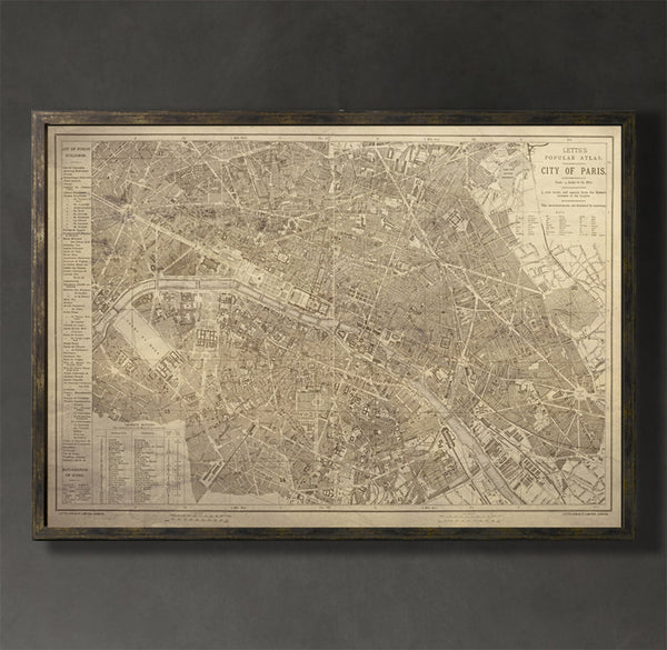
Map Print, PARIS
$29.00
This Paris map print captures the Paris of the mid-19th century when the medieval neighborhoods still stood strong. The renovation that followed the demolition of these neighborhoods stretched well into the 20th century and resulted in the reimagining of the city as the one we dream about today. This vintage map reproduction is more than a statement piece; it is a time machine that transports the viewer into the long gone streets of Paris. It allows the viewer to relive a time when electricity didn’t light up the city streets and the Eiffel tower wasn’t yet a staple of the skyline.
The purchase of this listing is for one map print of the city of Paris with the following specifications and options:
Style: Map of Paris, France (Circa 1853)
Sizes available: 18 x 24, 24 x 36 or 36 x 48 inches
Colors available: Black, white, or sepia
Materials: 100# premium card stock
Your Paris print does not include a frame but will be mailed to you via USPS First Class in a durable shipping tube. You can return to the GeoArtShed shop home to find more Paris wall art, Paris home décor, or Paris dorm decor following this link:
http://www.geoartshed.com/collections/print-posters-city-maps
© Copyright 2013 GeoArtShed. Artwork may not be reproduced or resold.
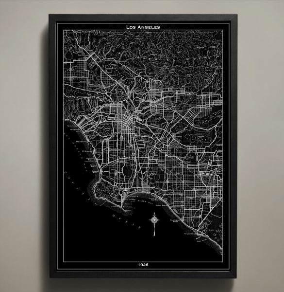
Map Print, LOS ANGELES
$29.00
Explore the early days of the City of Angels with this striking Los Angeles city map. Reproduced using high quality cardstock and premium ink, this LA poster features all the waterways, streets, and monuments of 1926 Los Angeles. There is a certain mystique that can only be found in the side streets of LA and it speaks to neon lights, salt on the breeze, and the potential for endless summers. As you explore this city print with your eyes, what discoveries will you find tucked away in this divine city of the past?
The purchase of this listing is for one Los Angeles city map print with the following specifications and options:
Style: Map of Los Angeles, California (Circa 1926)
Sizes available: 18 x 24, 24 x 36 or 36 x 48 inches
Colors available: Black or white
Materials: 100# premium card stock
Please note the purchase of this LA poster does not include a frame. Your map of Los Angeles poster will be mailed via USPS First Class and preserved in a durable shipping tube. If you would like to continue to shop for more LA prints, Los Angeles office décor, or map prints for your favorite city you may return to the GeoArtShed by clicking the following link:
http://www.geoartshed.com/collections/print-posters-city-maps
© Copyright 2013 GeoArtShed. Artwork may not be reproduced or resold.
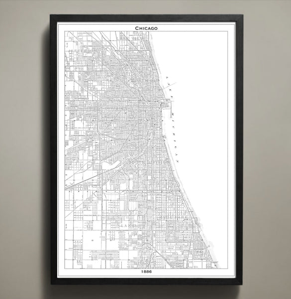
Map Print, CHICAGO
$29.00
Chicago is more than just the home to deep dish pizza and an everlasting love of the Bulls. Chicago is home to people that are strong and proud and it is a city that defines what it means to be a hardworking American. This Chicago print details the compact streets and over fifteen miles of beach in this recreation of a vintage 1886 map. Expertly produced using high quality cardstock and archival ink, this Chicago poster will elevate your home or office with the distinct complexity of the Chicago of the 1800s.
The purchase of this listing is for one Chicago city map print with the following specifications and options:
Style: Map of Chicago, Illinois (Circa 1886)
Sizes available: 18 x 24, 24 x 36 or 36 x 48 inches
Colors available: Black or white
Materials: 100# premium card stock
Please note the purchase of this Chicago poster does not include a frame. Your map of Chicago poster will be mailed via USPS First Class and preserved in a durable shipping tube. If you would like to continue to shop for more Illinois state pride décor, map prints, or various map posters you may return to the GeoArtShed by clicking the following link: City Map Prints
© Copyright 2013 GeoArtShed. Artwork may not be reproduced or resold.
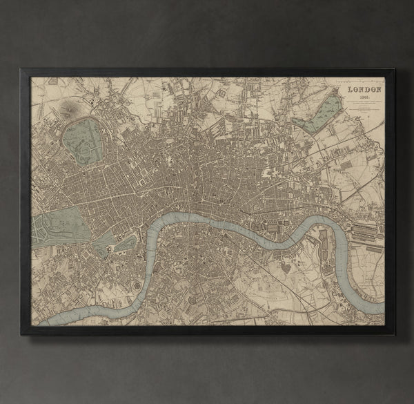
Map Print, LONDON
$29.00
London was a masterpiece of civil engineering by the end of the Industrial Revolution and this vintage map reproduction captures this majesty with expert precision. This London map print is a recreation of a vintage 1843 map and hints at the incredible difficulty and imaginative acrobatics civil engineers of the time needed to create the cityscape. This map of London also prominently displays the River Thames snaking through the manmade structures and offers a sharp contrast that elevates this typography print into a true piece of art.
The purchase of this listing is for one map print of the city of London with the following specifications and options:
Style: Map of London, England (Circa 1843)
Sizes available: 18 x 24, 24 x 36 or 36 x 48 inches
Colors available: Black, white, or sepia
Materials: 100# premium card stock
Your London print does not include a frame but will be mailed to you via USPS First Class in a durable shipping tube. You can return to the GeoArtShed shop home to find more city map prints, cityscape posters, or gifts for Anglophiles by following this link:
http://www.geoartshed.com/collections/print-posters-city-maps
© Copyright 2013 GeoArtShed. Artwork may not be reproduced or resold.
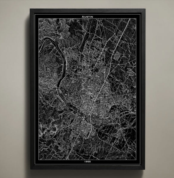
Map Print, AUSTIN
$29.00
This vintage style map print captures the streets, alleys, and byways of the great city of Austin, Texas. Known as the City of the Violet crown for its splendid display of purple, lavender, and of course violet wildflowers that light up the hills during sunset, this grid style map seeks to highlight the hills and the streets with realistic sophistication. This Austin city poster would make an ideal gift for any lifelong resident or newcomer to this great city and is always a popular option for Texas home décor.
The purchase of this listing is for one Austin city map print with the following specifications and options:
Style: Map of Austin, Texas (Circa 1955)
Sizes available: 18 x 24, 24 x 36 or 36 x 48 inches
Colors available: Black or white
Materials: 100# premium card stock
Please note the purchase of this Austin poster does not include a frame. Your map of Austin poster will be mailed via USPS First Class and preserved in a durable shipping tube. If you would like to continue to shop for more potential map prints, map posters, or new graduate gifts and office decorations you may return to the GeoArtShed by clicking the following link:
https://www.GeoArtShed.com
© Copyright 2013 GeoArtShed. Artwork may not be reproduced or resold.
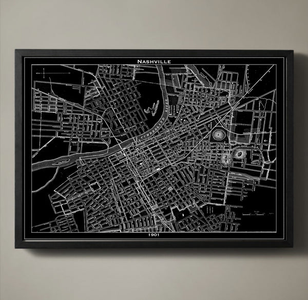
Map Print, NASHVILLE
$29.00
Step inside the magical world of Music City at the turn of the century with this vintage map poster. The city of Nashville, Tennessee holds gems such as Union Station, Carnegie Library, and Hermitage Hotel but this vintage map poster captures the glory of Nashville nearly two decades before any of those accomplishments graced the land. Interestingly, this map poster captures the original names of many of Nashville’s streets as they were renamed only three short years later to the monikers we know and love today. Take a closer look Avenues 1st – 21st and you’ll be treated to a rare glimpse of American history that you can revisit over and over again in your very own home.
The purchase of this listing is for one map print of the city of Nashville with the following specifications and options:
Style: Map of Nashville, Tennessee (Circa 1891)
Sizes available: 18 x 24, 24 x 36 or 36 x 48 inches
Colors available: Black or white
Materials: 100# premium card stock
Your Nashville print does not include a frame but will be mailed to you via USPS First Class in a durable shipping tube. You can return to the GeoArtShed shop home to find more going away gifts, Nashville home décor, or Nashville office decorations by following this link:
http://www.geoartshed.com/collections/print-posters-city-maps
© Copyright 2013 GeoArtShed. Artwork may not be reproduced or resold.
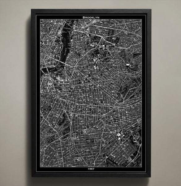
Map Print, BROOKLYN
$29.00
Brooklyn is the most populous of the five New York City boroughs and is well known for their signature attitude and character. This Brooklyn map is actual a recreation of a 1967 Brooklyn street grid and it captures the glamorous grit that can be found in each little subsection. As your eyes trace the different lines and you read the names of streets, landmarks, and buildings you will quickly understand why the official motto of this borough is “Unity brings strength”.
The purchase of this listing is for one Brooklyn city map print with the following specifications and options:
Style: Map of Brooklyn, New York (Circa 1967)
Sizes available: 18 x 24, 24 x 36 or 36 x 48 inches
Colors available: Black or white
Materials: 100# premium card stock
Please note the purchase of this Brooklyn poster does not include a frame. Your map of Brooklyn poster will be mailed via USPS First Class and preserved in a durable shipping tube. If you would like to continue to shop for more New York city maps, map prints, or potential gifts for New Yorkers you may return to the GeoArtShed by clicking the following link: City Map Prints
© Copyright 2013 GeoArtShed. Artwork may not be reproduced or resold.
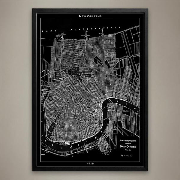
Map Print, NEW ORLEANS
$29.00
There's no city like quite New Orleans. Its rich culture can be found on every street depicted here in this 1919 New Orleans map print poster. Yet its greatness lies in its roots and as the "Birthplace of Jazz" it has deep ones. Our map is available in three different sizes in both black and white.
————————————————————————
Vintage Map Print Sizes Available
18” x 24” $29
24” x 36” $63
36” x 48” $118
Frame not included.
© Copyright 2013 GeoArtShed. Artwork may not be reproduced or resold
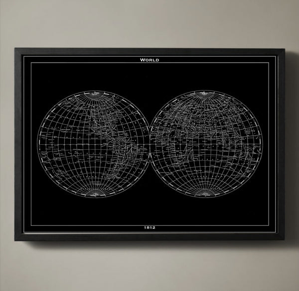
Map Print, WORLD
$29.00
A reproduction of a handmade map from 1812, our world map displays our entire globe in an eye-catching fashion. Each country and every ocean is accounted for, delicately labeled and available in either black or white. This vintage style world map is printed on premium archival stock with a 1/2 inch border around the poster's edge so that you can frame it with ease.
————————————————————————
Vintage Map Print Sizes Available
18” x 24” $29
24” x 36” $63
36” x 48” $118
Frame not included.
© Copyright 2013 GeoArtShed. Artwork may not be reproduced or resold
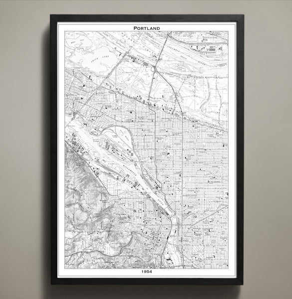
Map Print, PORTLAND
$29.00
Portland is a city of artists, dreamers and thinkers. This Portland map print poster not only shows its streets, parks, bridges and highways, it also shows the distinct divide of the Willamette River. Order this map in your choice of three different sizes; 18x24, 24x36 or 36x48 inches. Each print comes on archival that will last you for years to come.
————————————————————————
Vintage Map Print Sizes Available
18” x 24” $29
24” x 36” $63
36” x 48” $118
Frame not included.
© Copyright 2013 GeoArtShed. Artwork may not be reproduced or resold

Map Print, HAVANA
$29.00
In the 1860s the Cuban capitol of Havana had been trading with the Caribbean and North America for about 50 years. Its healthy trade treaties lead to the construction of a railroad, making the country of Cuba the 5th in the world to have a railroad. Just three years before this original map was created the city walls were knocked down to make room for expansion. In our beautiful recreation of an important piece of history you can see all that Havana has to offer- its busy port, railroad, and its expanded city walls along with every city street, tunnel and bridge.
————————————————————————
Vintage Map Print Sizes Available
18” x 24” $29
24” x 36” $63
36” x 48” $118
Frame not included.
© Copyright 2013 GeoArtShed. Artwork may not be reproduced or resold
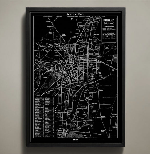
Map Print, MEXICO CITY
$29.00
Available in both black and white, our Mexico City map print poster is a detailed reproduction of an original 1956 map. It wasn't until this time that the city saw its most significant growth with the addition of skyscrapers and new architecture as well as newly established colonies. Printed on premium archival stock with a 1/2 inch border around the poster's edge for easy framing, this poster is available in three different sizes.
————————————————————————
Vintage Map Print Sizes Available
18” x 24” $29
24” x 36” $63
36” x 48” $118
Frame not included.
© Copyright 2013 GeoArtShed. Artwork may not be reproduced or resold
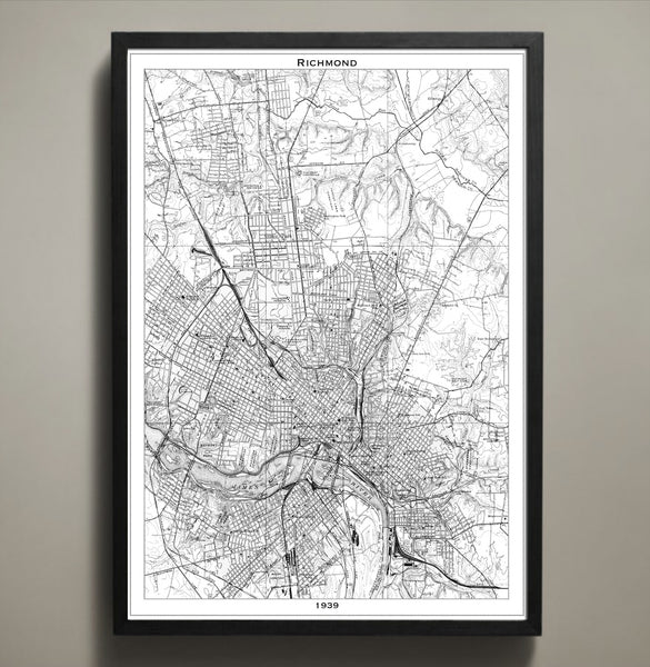
Map Print, RICHMOND
$29.00
This vintage style map print details the city of Richmond, Virginia as it stood in 1939. Richmond is the capital of the great state of Virginia and boasts Southern charm, a rich history, and picnic tables overflowing with ham biscuits, pimento cheese, and (of course) barbeque. This vintage map print is printed to your specifications in either a white or black scheme and features high quality cardstock and archival inks designed to last a lifetime.
The purchase of this listing is for one Richmond city map print with the following specifications and options:
Style: Map of Richmond, Virginia (Circa 1939)
Sizes available: 18 x 24, 24 x 36 or 36 x 48 inches
Colors available: Black or white
Materials: 100# premium card stock
Please note the purchase of this Richmond poster does not include a frame. Your map of Richmond poster will be mailed via USPS First Class and preserved in a durable shipping tube. If you would like to continue to shop for more map prints, map posters, or new graduate gifts and office decorations you may return to the GeoArtShed by clicking the following link:
http://www.geoartshed.com/collections/print-posters-city-maps
© Copyright 2013 GeoArtShed. Artwork may not be reproduced or resold.
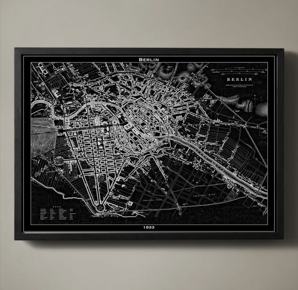
Map Print, BERLIN
$29.00
On paper Berlin looks like a burst of city streets that scatter outward, away from the city's hub and towards the countryside. In 1833 Berlin had yet to be surrounded by the Berlin wall or patrolled by guards. In the 1830s the streets were dusty and less crowded, freely traveled by horse-drawn carriage or by foot. All of our maps are printed on archival quality matte stock with a 1/2 inch border around the poster's edge for easy framing that you can do yourself or have professionally done.
————————————————————————
Vintage Map Print Sizes Available
18” x 24” $29
24” x 36” $63
36” x 48” $118
Frame not included.
© Copyright 2013 GeoArtShed. Artwork may not be reproduced or resold
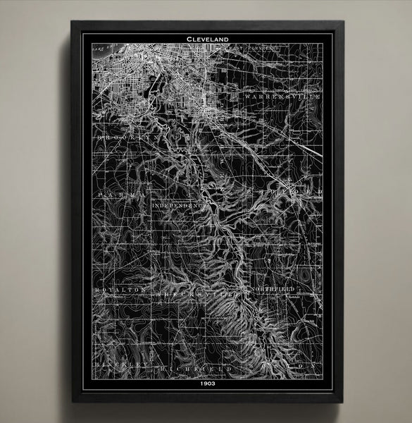
Map Print, CLEVELAND
$29.00
Our Cleveland print poster map's intricate detail makes for a stunning, visually pleasing work of art. Its winding streets and curving river mimic the skeletal remains of a fallen leaf. You can distinctly see its tightly built inner city and the contrast of the widely spread surrounding neighborhoods. Our 1903 map of Cleveland is available in black or white and in three different sizes, all printed on archival quality.
————————————————————————
Vintage Map Print Sizes Available
18” x 24” $29
24” x 36” $63
36” x 48” $118
Frame not included.
© Copyright 2013 GeoArtShed. Artwork may not be reproduced or resold
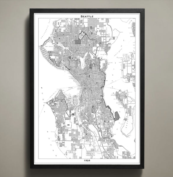
Map Print, SEATTLE
$29.00
Seattle, Washington has been known by many names including Jet City, Rain City, and the City of Goodwill. Inspire a touch of goodwill in your home or office when you display this delightfully vintage Seattle city map. This Seattle poster is expertly recreated from an accurate 1924 Seattle map and features high quality cardstock and premium archival ink in your choice of colors and sizes. This particular Seattle map print would be especially beloved by any University of Washington alumni or Seahawks fan.
The purchase of this listing is for one map print of the city of Seattle with the following specifications and options:
Style: Map of Seattle, Washington (Circa 1924)
Sizes available: 18 x 24, 24 x 36 or 36 x 48 inches
Colors available: Black or white
Materials: 100# premium card stock
Your Seattle print does not include a frame but will be mailed to you via USPS First Class in a durable shipping tube. You can return to the GeoArtShed shop home to find more map prints, map posters, or new graduate gifts and office decorations following this link:
http://www.geoartshed.com/collections/print-posters-city-maps
© Copyright 2013 GeoArtShed. Artwork may not be reproduced or resold.
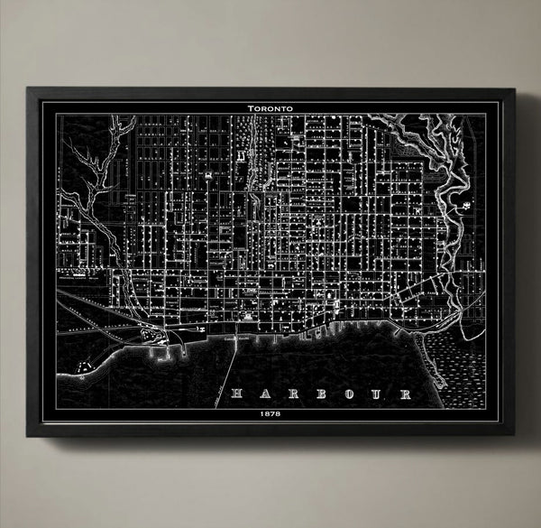
Map Print, TORONTO
$29.00
Toronto's skyline is distinct with its CN Tower rising into the sky far above the surrounding skyscrapers, but in 1878 the idea of erecting the world's tallest structure hadn't yet been a thought in anyone's mind. In 1878 when our map was originally sketched the town of Toronto was enjoying the newly built Union Station that connected the town to the Grand Trunk Railway and Northern Canada's railway. These new railroads, every bustling street and every port and dock of Toronto is captured in our map.
————————————————————————
Vintage Map Print Sizes Available
18” x 24” $29
24” x 36” $63
36” x 48” $118
Frame not included.
© Copyright 2013 GeoArtShed. Artwork may not be reproduced or resold
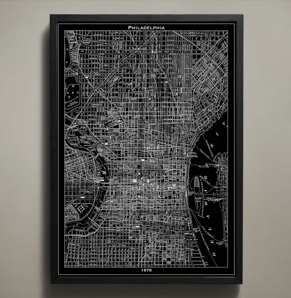
Map Print, PHILADELPHIA
$29.00
In 1876 Philadelphia was abuzz with the excitement of the first official US World’s Fair. People came from all across the country to take in the sights, sample the foods, and see unique creations that defied science and imagination alike. This Philadelphia poster seeks to rekindle that sense of wonder for the great city of Philly by reproducing an authentic 1876 map. This Philadelphia print is for the true civil engineering connoisseur because it marks each and every major street, tunnel, bridge, and neighborhood of this iconic city which is known for so much more than just crazy good cheesesteaks.
The purchase of this listing is for one Philadelphia city map print with the following specifications and options:
Style: Map of Philadelphia, Pennsylvania (Circa 1826)
Sizes available: 18 x 24, 24 x 36 or 36 x 48 inches
Colors available: Black or white
Materials: 100# premium card stock
Please note the purchase of this Philly poster does not include a frame. Your map of Philadelphia poster will be mailed via USPS First Class and preserved in a durable shipping tube. If you would like to continue to shop for more map posters, map prints, or gifts for denizens of the City of Brotherly Love you may return to the GeoArtShed by clicking the following link:
http://www.geoartshed.com/collections/print-posters-city-maps
© Copyright 2013 GeoArtShed. Artwork may not be reproduced or resold.
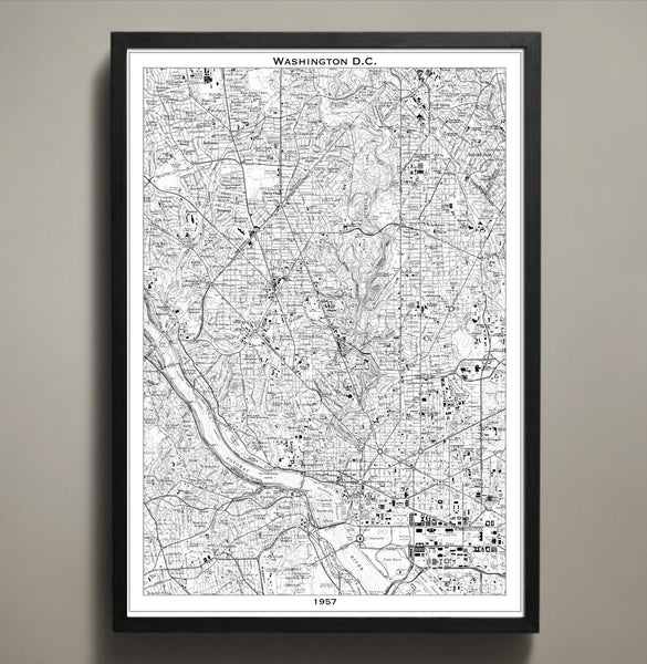
Map Print, WASHINGTON DC
$29.00
This Washington, DC map print poster mirrors the bustling, busy streets of the capitol in 1957 with amazing accuracy. It goes without saying that the history of Washington, DC is complex and staggering but what makes this particular map unique is that is a recreation of the cities infrastructure the same year that Martin Luther King made his “Give Us The Ballot” address winning over the hearts and minds of a generation previously uninspired. This DC poster would make a fantastic addition to any political enthusiasts’ home or office but is especially poignant for students studying civil engineering or civil liberties.
The purchase of this listing is for one map print of Washington, DC with the following specifications and options:
Style: Map of Washington, DC (Circa 1957)
Sizes available: 18 x 24, 24 x 36 or 36 x 48 inches
Colors available: Black or white
Materials: 100# premium card stock
Your DC print does not include a frame but will be mailed to you via USPS First Class in a durable shipping tube. You can return to the GeoArtShed shop home to find more map prints, map posters, or even typography wall art by following this link:
http://www.geoartshed.com/collections/print-posters-city-maps
© Copyright 2013 GeoArtShed. Artwork may not be reproduced or resold.
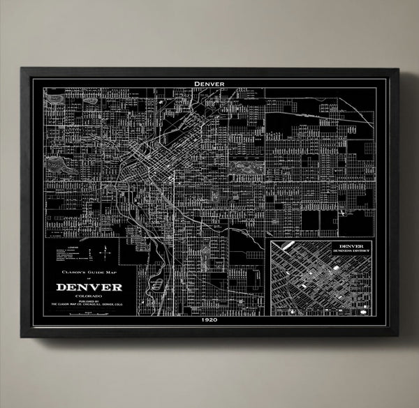
Map Print, DENVER
$29.00
The city of Denver is a product of the Gold Rush. Miners looking for gold made their way to the area in the mid-1800s. Eventually the settlement would become the state capital. Rail lines helped build the city and make Denver a hub for transportation and commerce. What is captured in our detailed 1920 map is the city following the Progressive Era and on the brink of a recession and the Great Depression. Add a piece of history to your wall with our Denver map poster printed on archival quality stock with a 1/2 inch border around the poster's edge for easy framing.
————————————————————————
Vintage Map Print Sizes Available
18” x 24” $29
24” x 36” $63
36” x 48” $118
Frame not included.
© Copyright 2013 GeoArtShed. Artwork may not be reproduced or resold
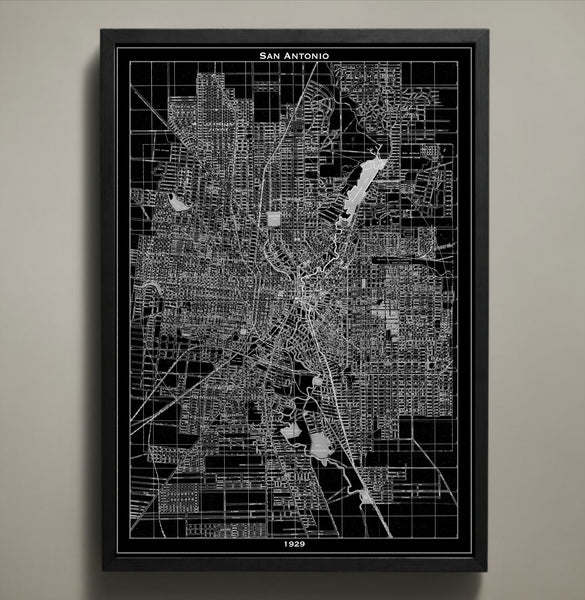
Map Print, SAN ANTONIO
$29.00
Each one of San Antonio's street names, tunnels, bridges, highways, parks and neighborhoods are clearly depicted in our San Antonio map print poster. Originally made in 1929, you can see the masterful artistry of its maker as clearly as if you were flying above the city yourself. Like all of our maps, this one is printed on quality paper that ensures it will last a lifetime. We also print our posters with an added 1/2 border for hassle free framing.
————————————————————————
Vintage Map Print Sizes Available
18” x 24” $29
24” x 36” $63
36” x 48” $118
Frame not included.
© Copyright 2013 GeoArtShed. Artwork may not be reproduced or resold
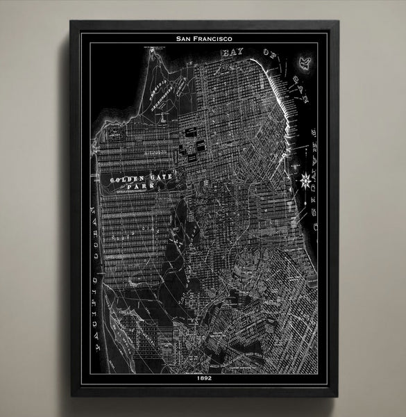
Map Print, SAN FRANCISCO
$29.00
There is a reason so many have left their hearts in San Francisco: It is a city that captures romance, culture, and diversity with unparalleled urban elegance. This San Francisco map print seeks to inspire you with a skeletal remembrance of the city in the late 1800s. As your fingers trace over the terrain, coastlines, and streets of yesteryear you will be transported to a time when San Francisco was young and ambitious but somehow still as full of life as it is today.
The purchase of this listing is for one map print of the city of San Francisco with the following specifications and options:
Style: Map of San Francisco, California (Circa 1892)
Sizes available: 18 x 24, 24 x 36 or 36 x 48 inches
Colors available: Black or white
Materials: 100# premium card stock
Your San Francisco print does not include a frame but will be mailed to you via USPS First Class in a durable shipping tube. You can return to the GeoArtShed shop home to find more map prints, vintage map reproductions, or map posters of a wide variety of cities by following this link:
http://www.geoartshed.com/collections/print-posters-city-maps
© Copyright 2013 GeoArtShed. Artwork may not be reproduced or resold.