Chicago Map Prints, Chicago In The 1800s
At the start of the 19th century Chicago was under attach. Fort Dearborn (built in 1803) came under attack by British forces and its inhabitants were killed or taken prisoner. It wasn't until 1818 that the fort was rebuilt and used into the late 1830s. In 1829 the population of Chicago was less than 100. The town was officially recognized in 1830 after the filing of the recognition of the municipality known as Chicago. Three years later Chicago was incorporated.
It was the area's rich farmland that attracted settlers and real estate operators were responsible for the overnight growth of the city. Farmlands grew as fast as the city and roads were built to enable hundreds of wagon shipments to enter the city every day.
Chicago became a shipping hub in 1848 when the Illinois and Michigan Canal was opened, creating clear access from the Great Lakes to the Mississippi River and down to the Gulf of Mexico. The same year the canal was opened the Galena & Chicago Union Railroad was completed. These new additions to the city -also including its roads and air travel- made Chicago the transportation hub of the US. National retailers would be the next entrepreneurs to take advantage of Chicago's perks, offering a new kind of shopping to consumers- catalog shopping.
In 1886 (the year our Chicago map was made) an immigrant landscape designer named Jens Jensen came to town and helped rebuild the city after the devastating Great Chicago Fire that burned approximately 18,000 buildings.
Once the city was seeing better days Chicago put on the most influential world's fair in history, bringing in over 27 million visitors. From there things began to look up once more for Chicago. The rise of industry and commerce were just around the corner. Expansion took to the streets and the skies making Chicago what it is today; one of the most populated cities in America.
Click Below to View our Chicago Map Prints!

London Map Prints, What It Was Like To Live In London in 1843
The London of 1843 was much different than the London we know today. Most of us know it to be a beautiful city with many attractions and historical sites, but in the 1840s this relatively small city wasn't quite a tourist friendly destination.
The London of the 1840s was an overcrowded city where the poor would share homes with other families. The rich did well for themselves, living in beautiful homes, but the poor lived difficult lives.
For those unable to support themselves workhouses were established. A workhouse was a place where people could go to live and work. These temporary homes were very beneficial for many people who struggled to make ends meet. Workhouses would turn into housing for the elderly and sick at the turn of the 20th century.
During the 1840s London women wore flowing dresses that showed their shoulders and had puffed sleeves. Their skirts were bell shaped like many we are familiar with seeing in period films. Their shoes and small handbags were mad of the same material, often embellished with lace.
Men wore top hats and bow ties. They had full-length trousers or breeches depending on the occasion. Informal day wear included a frock coat or cutaway morning coat. In the evening they would wear a dark tail coat with a pair of trousers.
The Tower of London, St. Paul's Cathedral and Westminster Abbey were landmarks at the time. During the 40s the Tower of London wasn't quite the tourist attraction we know it to be today. It was a violent place with a troubling reputation. St. Paul's Cathedral was much more inviting with hourly prayers and daily services.
Today London is a hub for those who love history and beautiful architecture. Millions of people visit from around the world each year to take in its culture and scenery. The city has come a long way from its 1800s lifestyle and is a beautiful destination to explore.
Click Below to View our London Map Prints!

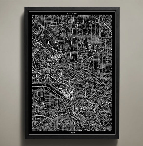
Dallas Map Prints, 5 Things Happening in Dallas in 1958
Today Dallas, Texas is the ninth most populated city in the United States and the third most populated in Texas, but what was happening in this great city back in 1958? Dallas had come a long way from its humble roots, yet wasn't quite at its nearly 1.3 million occupants. From farming and stockyards to engineering companies and the Dallas Cowboys football team, Dallas has a lot to be proud of.
- Dallas' minor league baseball team first known as the Dallas Rangers started their short Texas based career in 1958, playing in the Double-A Texas League their first year and then playing in the Triple-A American Association before relocating to Vancouver, Canada.
- In July of 1958 while American electrical engineer Jack Kilby was working at Texas Instruments in Dallas he drew up the idea for the silicon chip (also known as an integrated chip or microchip). This compact microchip changed the electrical inner workings of computers, mobile phones and home appliances. In 2000 Kilby was awarded the Nobel Prize in physics.
- Dallas based pianist Van Cliburn won the International Piano Competition in Moscow at the age of 23. He made Texas proud, playing for royalty, heads of state and every United States president from Harry S. Truman to Barack Obama.
- What was Dallas' weather like in 1958 you ask? The average high was 96 degrees. It got pretty warm that year with the highest recorded temperature hitting 103 degrees. There were 26 days of warmer than average highs before things started to cool off. December 14th was the coldest day with a temp of only 16 degrees.
- In 1958 the United States was home to over 174 million people. Fewer than one million of those lived in Dallas, contributing to its growing economy. The city would finally hit the 1 million mark in 1962.
Click Below to View our Boston Map Prints!
Los Angeles Map Prints, The Growth of LA
In 1877 Los Angeles was nothing more than a tiny, barely visible purple blob. Back then the city that would one day be referred to as The Entertainment Capitol of the World, was home to fewer than 4,400 occupants, with vineyards and orchards growing where houses, shops and hotels now stand. This map animation shows how Los Angeles grew from such humble beginnings to some of the most desirable southern California real estate.
The map shows a burst of growth from the late 1800s to the early 1900s, showing the city's transition from a village of 5,000 people to over 100,000 occupants. This rapid growth took place along with industrial expansion and the help of developers who wanted to turn it into a great city. The railroads also had a hand in Los Angeles' growth. The first one ran 21 miles from San Pedro to LA. The city saw significant growth after connecting to the Central Pacific Railroad in the late 1870s and the Santa Fe system in 1885. Watch the coastline take shape and expansion take place as we move into the 1940s and 50s. Los Angeles became an industrial and financial giant, producing aircrafts and war supplies for World War II and assembling more cars than any other city other than Detroit. Los Angeles also came in second behind Akron in the tire making business, made more furniture than the city of Grand Rapids and came in right behind New York in clothing production. All of this manufacturing was somewhat short lived. The auto factories shut down in the 1990s after the tire and steel factories were already long gone. The furniture industry's hub was now in Mexico and the agricultural and dairy operations moved to other counties.
However, these economic changes didn't stop the city of Los Angeles from eventually becoming the second most populous city in the United States. In fact, LA bounced back, reinvented itself and becoming a global city with a culture like no other which is why we had no choice but to create a vintage Los Angeles map print to represent this great city.
Click Below to View our Los Angeles Map Prints!
