
Map Print, DENVER
$29.00
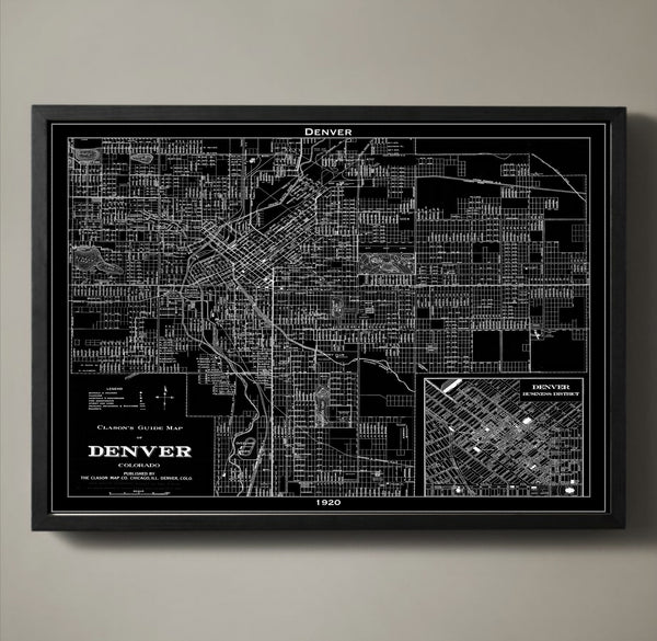
The city of Denver is a product of the Gold Rush. Miners looking for gold made their way to the area in the mid-1800s. Eventually the settlement would become the state capital. Rail lines helped build the city and make Denver a hub for transportation and commerce. What is captured in our detailed 1920 map is the city following the Progressive Era and on the brink of a recession and the Great Depression. Add a piece of history to your wall with our Denver map poster printed on archival quality stock with a 1/2 inch border around the poster's edge for easy framing.
————————————————————————
Vintage Map Print Sizes Available
18” x 24” $29
24” x 36” $63
36” x 48” $118
Frame not included.
© Copyright 2013 GeoArtShed. Artwork may not be reproduced or resold

Map Print, DENVER
$29.00
The city of Denver is a product of the Gold Rush. Miners looking for gold made their way to the area in the mid-1800s. Eventually the settlement would become the state capital. Rail lines helped build the city and make Denver a hub for transportation and commerce. What is captured in our detailed 1920 map is the city following the Progressive Era and on the brink of a recession and the Great Depression. Add a piece of history to your wall with our Denver map poster printed on archival quality stock with a 1/2 inch border around the poster's edge for easy framing.
————————————————————————
Vintage Map Print Sizes Available
18” x 24” $29
24” x 36” $63
36” x 48” $118
Frame not included.
© Copyright 2013 GeoArtShed. Artwork may not be reproduced or resold
Map Print, DETROIT
$29.00
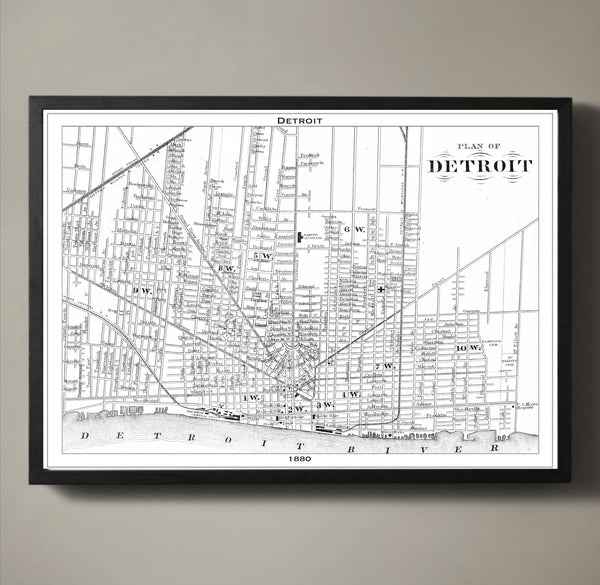
Today Detroit is the most populated city in Michigan and the largest city on the border of the US and Canada. Back in 1880 Detroit was known as the Paris of the West because of its beautiful architecture. Today Detroit is known for the first automobiles that rolled down its dusty roads and the stamp it had on that industry. What our 1880 map preserves are the iconic Detroit streets walked by men in suits, women in dresses and horses pulling carts. Each block, road, waterway and bridge is captured and preserved on our archival quality stock with a 1/2 inch border around the poster's edge for easy framing.
————————————————————————
Vintage Map Print Sizes Available
18” x 24” $29
24” x 36” $63
36” x 48” $118
Frame not included.
© Copyright 2013 GeoArtShed. Artwork may not be reproduced or resold
Map Print, Dublin
$29.00
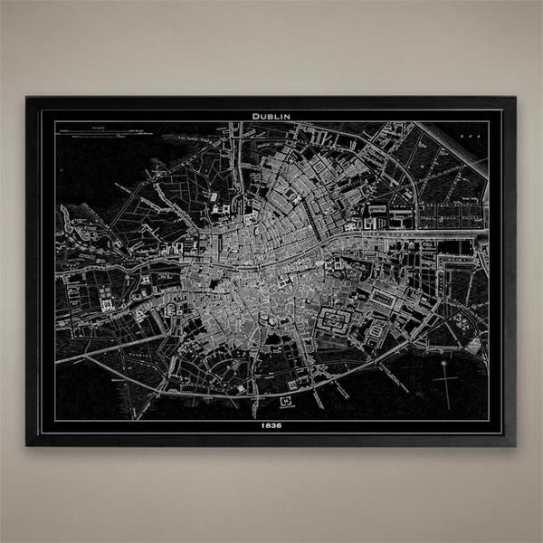
Dublin, Ireland Map Print, Black and White Dublin Wall Decor
————————————————————————
Vintage Map Print Sizes Available
18” x 24” $29
24” x 36” $63
36” x 48” $118
Frame not included.
© Copyright 2013 GeoArtShed. Artwork may not be reproduced or resold

Map Print, HAVANA
$29.00
In the 1860s the Cuban capitol of Havana had been trading with the Caribbean and North America for about 50 years. Its healthy trade treaties lead to the construction of a railroad, making the country of Cuba the 5th in the world to have a railroad. Just three years before this original map was created the city walls were knocked down to make room for expansion. In our beautiful recreation of an important piece of history you can see all that Havana has to offer- its busy port, railroad, and its expanded city walls along with every city street, tunnel and bridge.
————————————————————————
Vintage Map Print Sizes Available
18” x 24” $29
24” x 36” $63
36” x 48” $118
Frame not included.
© Copyright 2013 GeoArtShed. Artwork may not be reproduced or resold
Map Print, HONOLULU
$29.00
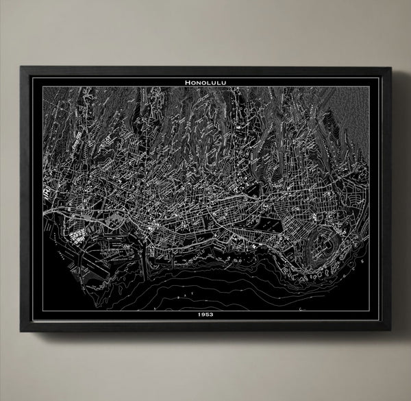
Honolulu Map Print. Printed on premium stock using archival ink, this map print will last a lifetime.
————————————————————————
Vintage Map Print Sizes Available
18” x 24” $29
24” x 36” $63
36” x 48” $118
Frame not included.
© Copyright 2013 GeoArtShed. Artwork may not be reproduced or resold
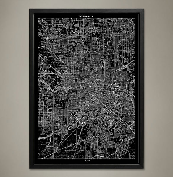
Map Print, Houston
$29.00
This map of Houston revisits a simpler time in the city’s history: The 1950s. A reproduced vintage map details the city streets, monuments, and major landmarks of Houston, Texas with expert precision allowing the viewer to return to this nostalgic period. Houston is now nicknamed the “Space City” for its global presence in the fields of international trade, technology, education, and medicine but once it was a growing metropolis with just a hint of the fantastic future. This map print would make a phenomenal addition to any office in the great city of Houston or as a reminder of where they came from if they went out into the world to make their mark.
The purchase of this listing is for one Houston city map print with the following specifications and options:
Style: Map of Houston, Texas (Circa 1955)
Sizes available: 18 x 24, 24 x 36 or 36 x 48 inches
Colors available: Black or white
Materials: 100# premium card stock
Please note the purchase of this Houston poster does not include a frame. Your map of Houston poster will be mailed via USPS First Class and preserved in a durable shipping tube. If you would like to continue to shop for more map prints, map posters, and Texas office decor you may return to the GeoArtShed by clicking the following link:
http://www.geoartshed.com/collections/print-posters-city-maps
© Copyright 2013 GeoArtShed. Artwork may not be reproduced or resold.
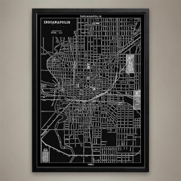
Map Print, Indianapolis
$29.00
INDIANAPOLIS Map Print, Black and White Indianapolis Wall Decor
Known as "The Crossroads of America" for its roads that lead to cities like St. Louis and Chicago, Indianapolis, Indianapolis became the state capital of Indiana and the county seat for Marion County. Indianapolis is also known as the city that rivaled Detroit. It grew to be a large automobile manufacturing city at the turn of the 20th century and kept up its status for many years. Our 1901 Indianapolis map is printed on premium archival stock with a 1/2 inch border around the poster's edge for easy framing. Hang this piece of history in any home or office wall. ————————————————————————
Vintage Map Print Sizes Available
18” x 24” $29
24” x 36” $63
36” x 48” $118
Frame not included.
© Copyright 2013 GeoArtShed. Artwork may not be reproduced or resold
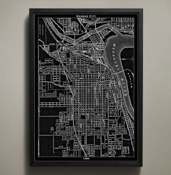
Map Print, KANSAS CITY
$29.00
This map of Kansas City details the stockyards and history of 1889; these stockyards are no more than a memory after being carried away in the cascading waves of the Great Flood of 1951. Now you can travel back in time with this KC poster to take a closer look at the late 19th century structures, streets, and waterways. This map of Kansas City reminds the viewer that this populous place is more than just the home of barbeque, blues, and jazz; it is the home of a rich history of Americana.
The purchase of this listing is for one map print of the city of Kansas City with the following specifications and options:
Style: Map of Kansas City, Missouri (Circa 1924)
Sizes available: 18 x 24, 24 x 36 or 36 x 48 inches
Colors available: Black or white
Materials: 100# premium card stock
Your KC print does not include a frame but will be mailed to you via USPS First Class in a durable shipping tube. You can return to the GeoArtShed shop home to find more map posters, map prints, and Kansas City memorabilia by following this link:
http://www.geoartshed.com/collections/print-posters-city-maps
© Copyright 2013 GeoArtShed. Artwork may not be reproduced or resold.
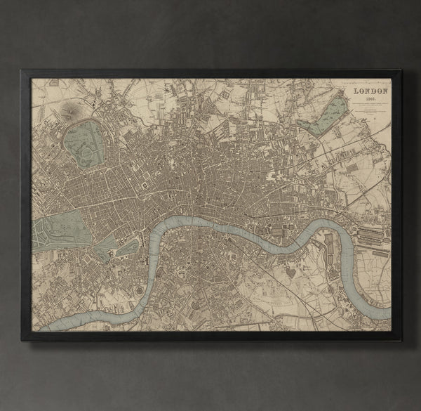
Map Print, LONDON
$29.00
London was a masterpiece of civil engineering by the end of the Industrial Revolution and this vintage map reproduction captures this majesty with expert precision. This London map print is a recreation of a vintage 1843 map and hints at the incredible difficulty and imaginative acrobatics civil engineers of the time needed to create the cityscape. This map of London also prominently displays the River Thames snaking through the manmade structures and offers a sharp contrast that elevates this typography print into a true piece of art.
The purchase of this listing is for one map print of the city of London with the following specifications and options:
Style: Map of London, England (Circa 1843)
Sizes available: 18 x 24, 24 x 36 or 36 x 48 inches
Colors available: Black, white, or sepia
Materials: 100# premium card stock
Your London print does not include a frame but will be mailed to you via USPS First Class in a durable shipping tube. You can return to the GeoArtShed shop home to find more city map prints, cityscape posters, or gifts for Anglophiles by following this link:
http://www.geoartshed.com/collections/print-posters-city-maps
© Copyright 2013 GeoArtShed. Artwork may not be reproduced or resold.
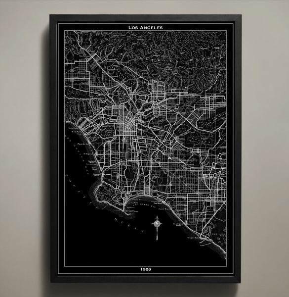
Map Print, LOS ANGELES
$29.00
Explore the early days of the City of Angels with this striking Los Angeles city map. Reproduced using high quality cardstock and premium ink, this LA poster features all the waterways, streets, and monuments of 1926 Los Angeles. There is a certain mystique that can only be found in the side streets of LA and it speaks to neon lights, salt on the breeze, and the potential for endless summers. As you explore this city print with your eyes, what discoveries will you find tucked away in this divine city of the past?
The purchase of this listing is for one Los Angeles city map print with the following specifications and options:
Style: Map of Los Angeles, California (Circa 1926)
Sizes available: 18 x 24, 24 x 36 or 36 x 48 inches
Colors available: Black or white
Materials: 100# premium card stock
Please note the purchase of this LA poster does not include a frame. Your map of Los Angeles poster will be mailed via USPS First Class and preserved in a durable shipping tube. If you would like to continue to shop for more LA prints, Los Angeles office décor, or map prints for your favorite city you may return to the GeoArtShed by clicking the following link:
http://www.geoartshed.com/collections/print-posters-city-maps
© Copyright 2013 GeoArtShed. Artwork may not be reproduced or resold.
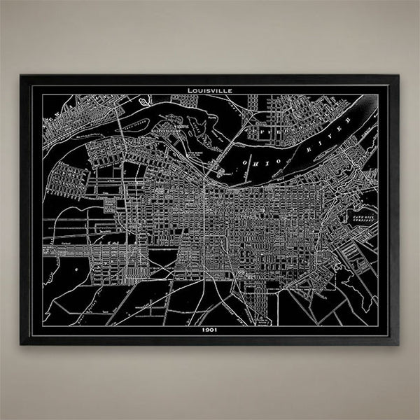
Map Print, Louisville
$29.00
Map Print, Louisville
Vintage Map Print Sizes Available
18” x 24” $29
24” x 36” $63
36” x 48” $118
Frame not included.
© Copyright 2013 GeoArtShed. Artwork may not be reproduced or resold
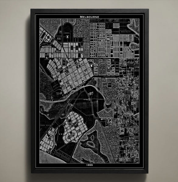
Map Print, MELBOURNE
$29.00
Today Melbourne is a lively neon lit city that attracts visitors from all over the world, but back in the mid-1800s the Australian city wasn't quite the tourist hub we know it to be today. Its streets depicted in our 1855 map would have been filled with people riding horseback, carriages and people covered from head to toe in dresses and pant suites- even in the warm climate. All of our maps are printed on archival quality stock and this particular map is available in both black and white.
————————————————————————
Vintage Map Print Sizes Available
18” x 24” $29
24” x 36” $63
36” x 48” $118
Frame not included.
© Copyright 2013 GeoArtShed. Artwork may not be reproduced or resold
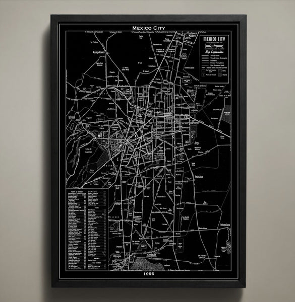
Map Print, MEXICO CITY
$29.00
Available in both black and white, our Mexico City map print poster is a detailed reproduction of an original 1956 map. It wasn't until this time that the city saw its most significant growth with the addition of skyscrapers and new architecture as well as newly established colonies. Printed on premium archival stock with a 1/2 inch border around the poster's edge for easy framing, this poster is available in three different sizes.
————————————————————————
Vintage Map Print Sizes Available
18” x 24” $29
24” x 36” $63
36” x 48” $118
Frame not included.
© Copyright 2013 GeoArtShed. Artwork may not be reproduced or resold
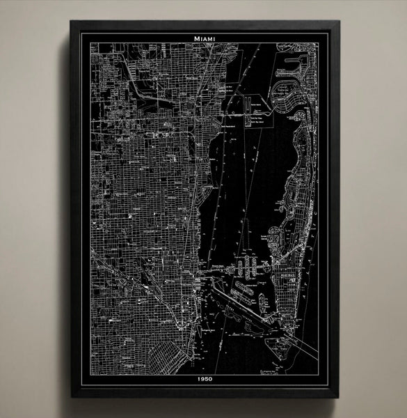
Map Print, MIAMI
$29.00
This is our vintage 1950 Miami map. Our Miami map shows a detailed street grid of the city of Miami. You can clearly see street names, parks, tunnels, bridges, highways and neighborhoods when viewing my prints in person. They look amazing on any wall!
————————————————————————
Vintage Map Print Sizes Available
18” x 24” $29
24” x 36” $63
36” x 48” $118
Frame not included.
© Copyright 2013 GeoArtShed. Artwork may not be reproduced or resold
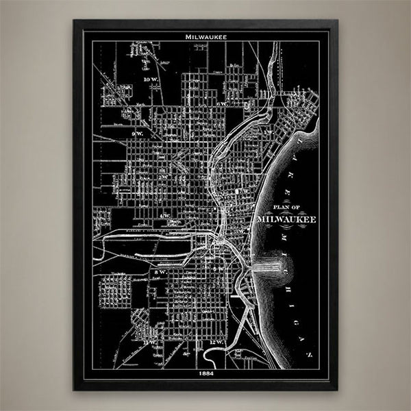
Map Print, Milwaukee
$29.00
Map Print, Milwaukee
————————————————————————
Vintage Map Print Sizes Available
18” x 24” $29
24” x 36” $63
36” x 48” $118
Frame not included.
© Copyright 2013 GeoArtShed. Artwork may not be reproduced or resold
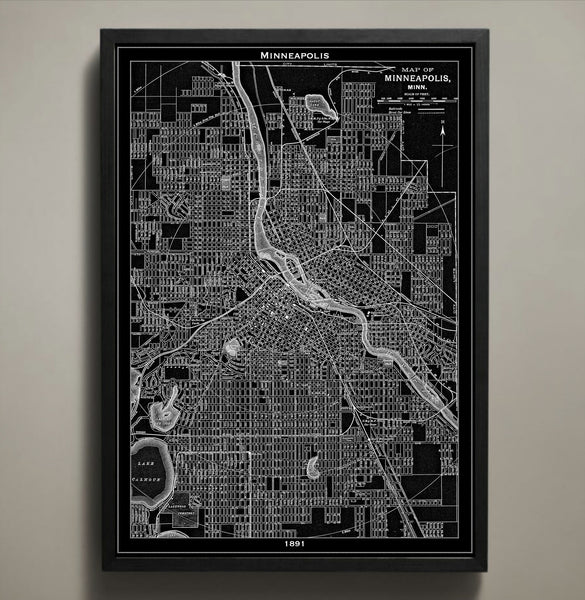
Map Print, MINNEAPOLIS
$29.00
This Minneapolis map print takes a closer look at the famous waterways, streets, bridges, and tunnels that were present there during the late 1800s. Reproduced from a vintage 1891 map, every inch of this city is captured with astounding precision and intrigues the viewer with crevices of the city not normally explored. While Minneapolis, Minnesota is currently the larger of the twin cities at nearly 3.5 million residents, this vintage map reproduction shows the city in a more nascent period when it was still being built upon the commerce of water and wetlands.
The purchase of this listing is for one map print of the city of Minneapolis with the following specifications and options:
Style: Map of Minneapolis, Minnesota (Circa 1891)
Sizes available: 18 x 24, 24 x 36 or 36 x 48 inches
Colors available: Black or white
Materials: 100# premium card stock
Your Minneapolis print does not include a frame but will be mailed to you via USPS First Class in a durable shipping tube. You can return to the GeoArtShed shop home to find more map prints, map posters, or even Minneapolis wall art by following this link:
http://www.geoartshed.com/collections/print-posters-city-maps
© Copyright 2013 GeoArtShed. Artwork may not be reproduced or resold.
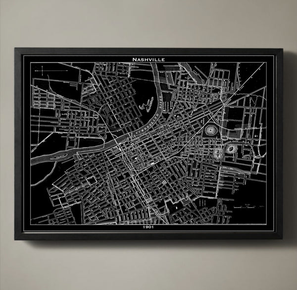
Map Print, NASHVILLE
$29.00
Step inside the magical world of Music City at the turn of the century with this vintage map poster. The city of Nashville, Tennessee holds gems such as Union Station, Carnegie Library, and Hermitage Hotel but this vintage map poster captures the glory of Nashville nearly two decades before any of those accomplishments graced the land. Interestingly, this map poster captures the original names of many of Nashville’s streets as they were renamed only three short years later to the monikers we know and love today. Take a closer look Avenues 1st – 21st and you’ll be treated to a rare glimpse of American history that you can revisit over and over again in your very own home.
The purchase of this listing is for one map print of the city of Nashville with the following specifications and options:
Style: Map of Nashville, Tennessee (Circa 1891)
Sizes available: 18 x 24, 24 x 36 or 36 x 48 inches
Colors available: Black or white
Materials: 100# premium card stock
Your Nashville print does not include a frame but will be mailed to you via USPS First Class in a durable shipping tube. You can return to the GeoArtShed shop home to find more going away gifts, Nashville home décor, or Nashville office decorations by following this link:
http://www.geoartshed.com/collections/print-posters-city-maps
© Copyright 2013 GeoArtShed. Artwork may not be reproduced or resold.
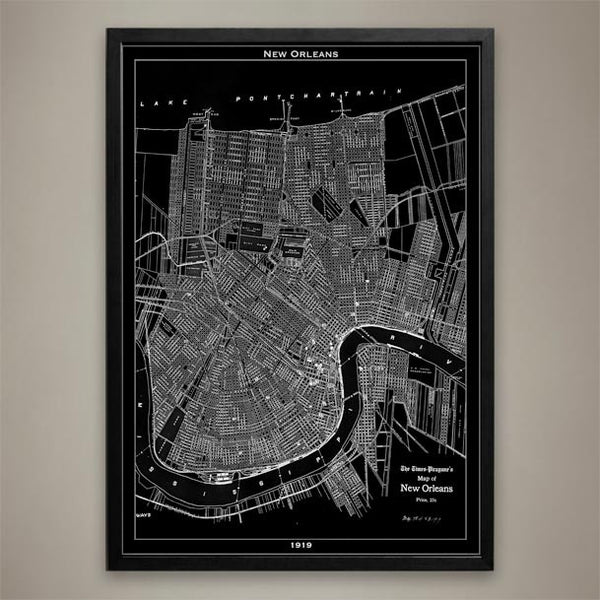
Map Print, NEW ORLEANS
$29.00
There's no city like quite New Orleans. Its rich culture can be found on every street depicted here in this 1919 New Orleans map print poster. Yet its greatness lies in its roots and as the "Birthplace of Jazz" it has deep ones. Our map is available in three different sizes in both black and white.
————————————————————————
Vintage Map Print Sizes Available
18” x 24” $29
24” x 36” $63
36” x 48” $118
Frame not included.
© Copyright 2013 GeoArtShed. Artwork may not be reproduced or resold
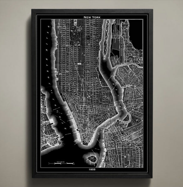
Map Print, NEW YORK CITY
$29.00
The black version of our magnificent New York City map print highlights the abstract detail of this piece of art and the original cartographer's work. Its white version makes the streets, waterways and bridges jump out at you. Whether you're drawn to the black or the white city map prints, there's no mistaking what city is depicted in these maps. Those who love NYC will enjoy discovering it block by block. All of our map prints are printed on high quality archival paper that will last a lifetime. This 1855 New York City map print will take you back in time and add character to any wall in your home or office. If you are looking for another city to pair with our New York City map print you can view our entire collection of map prints here:
Frame not included.
© Copyright 2013 GeoArtShed. Artwork may not be reproduced or resold
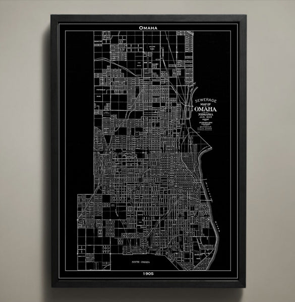
Map Print, Omaha
$29.00
Map Print, Omaha
Vintage Map Print Sizes Available
18” x 24” $29
24” x 36” $63
36” x 48” $118
Frame not included.
© Copyright 2013 GeoArtShed. Artwork may not be reproduced or resold
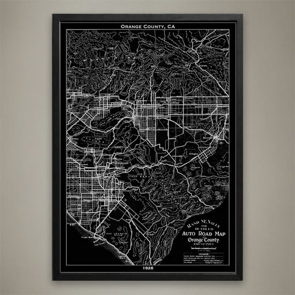
Map Print, ORANGE COUNTY, CA
$29.00
Map Print, ORANGE COUNTY, CA
————————————————————————
Vintage Map Print Sizes Available
18” x 24” $29
24” x 36” $63
36” x 48” $118
Frame not included.
© Copyright 2013 GeoArtShed. Artwork may not be reproduced or resold
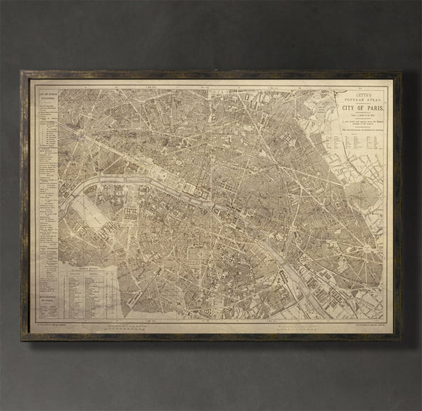
Map Print, PARIS
$29.00
This Paris map print captures the Paris of the mid-19th century when the medieval neighborhoods still stood strong. The renovation that followed the demolition of these neighborhoods stretched well into the 20th century and resulted in the reimagining of the city as the one we dream about today. This vintage map reproduction is more than a statement piece; it is a time machine that transports the viewer into the long gone streets of Paris. It allows the viewer to relive a time when electricity didn’t light up the city streets and the Eiffel tower wasn’t yet a staple of the skyline.
The purchase of this listing is for one map print of the city of Paris with the following specifications and options:
Style: Map of Paris, France (Circa 1853)
Sizes available: 18 x 24, 24 x 36 or 36 x 48 inches
Colors available: Black, white, or sepia
Materials: 100# premium card stock
Your Paris print does not include a frame but will be mailed to you via USPS First Class in a durable shipping tube. You can return to the GeoArtShed shop home to find more Paris wall art, Paris home décor, or Paris dorm decor following this link:
http://www.geoartshed.com/collections/print-posters-city-maps
© Copyright 2013 GeoArtShed. Artwork may not be reproduced or resold.
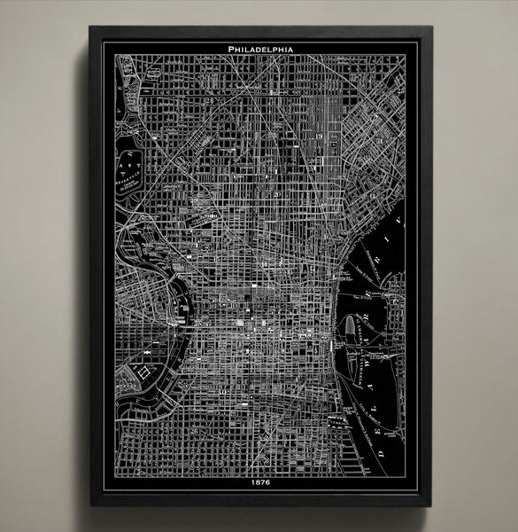
Map Print, PHILADELPHIA
$29.00
In 1876 Philadelphia was abuzz with the excitement of the first official US World’s Fair. People came from all across the country to take in the sights, sample the foods, and see unique creations that defied science and imagination alike. This Philadelphia poster seeks to rekindle that sense of wonder for the great city of Philly by reproducing an authentic 1876 map. This Philadelphia print is for the true civil engineering connoisseur because it marks each and every major street, tunnel, bridge, and neighborhood of this iconic city which is known for so much more than just crazy good cheesesteaks.
The purchase of this listing is for one Philadelphia city map print with the following specifications and options:
Style: Map of Philadelphia, Pennsylvania (Circa 1826)
Sizes available: 18 x 24, 24 x 36 or 36 x 48 inches
Colors available: Black or white
Materials: 100# premium card stock
Please note the purchase of this Philly poster does not include a frame. Your map of Philadelphia poster will be mailed via USPS First Class and preserved in a durable shipping tube. If you would like to continue to shop for more map posters, map prints, or gifts for denizens of the City of Brotherly Love you may return to the GeoArtShed by clicking the following link:
http://www.geoartshed.com/collections/print-posters-city-maps
© Copyright 2013 GeoArtShed. Artwork may not be reproduced or resold.